Ever wonder what “live-water” really means when you see it in a Gallatin Valley listing? If you’re eyeing riverfront near Manhattan, you want more than a pretty view. You want flowing water you can enjoy, a property you can build on, and a purchase you can feel great about. In this guide, you’ll learn exactly how live-water is defined locally, what affects value near the Gallatin and Missouri headwaters, and the due diligence steps that protect your investment. Let’s dive in.
What “live-water” means here
In the Manhattan area, “live-water” means a flowing, perennial watercourse with enough movement and oxygen to support aquatic life. Think trout water. The Gallatin River and its tributaries are classic examples. They are cold, spring and snowmelt fed, and typically flow year round.
You’re also near one of Montana’s iconic confluences. The Gallatin meets the Madison and Jefferson at the Missouri River headwaters in Three Forks. That headwaters setting shapes how the river behaves: higher flows in spring during runoff, then lower flows in late summer. When a listing says live-water, you should expect continuous flow most years, along with a functioning cold-water ecosystem. Not every channel on a map delivers the same experience, so it pays to verify permanence, access, and bank stability.
Why live-water drives value near Manhattan
Live-water commands a premium for several reasons:
- Scenic views and daily connection to the river lifestyle.
- On-site recreation like wading, kayaking, and wildlife viewing.
- Fishery quality that attracts anglers when insect hatches and flows cooperate.
- Scarcity of usable, private frontage per parcel.
There are also constraints that can affect value and use:
- Seasonal flow swings. Snowmelt brings high spring water, while late summer can run lower, especially in dry years.
- Upstream irrigation diversions that may reduce summer flows through your stretch.
- Flood risk and bank erosion that can affect buildability and maintenance.
- Public access below the ordinary high-water mark, which can increase recreation traffic near your banks.
- Permitting limits on channel changes, bank armoring, or in-stream work.
- Water quality considerations tied to nearby land uses or failing septic systems.
Regional climate trends point to earlier runoff and potentially lower late-summer baseflows in many Western basins. Plan for shifting timing of peak flows and angling windows.
What to verify before you fall in love
Water rights are separate from land
Owning river frontage does not automatically give you the right to divert or store water. Montana uses a prior-appropriation system managed by the Department of Natural Resources and Conservation. Always verify if the property includes recorded water rights, the type of use, the priority date, and any conditions. If rights exist, confirm the file numbers and make sure diversion structures match the paperwork.
Public stream access rules
Montana allows the public to use riverbeds below the ordinary high-water mark for recreation. How people get to the water matters. Confirm whether your parcel has public access points nearby, or any routes or easements that cross the property. Understand the boundary between your private upland and the public bed to manage expectations and privacy.
Floodplain and setbacks
Floodplain designations influence insurance needs, mortgage approvals, and where you can build. Many riparian parcels have mapped flood risks. Confirm FEMA map status, base flood elevations, local floodplain permits, and minimum setbacks. Ask about any prior variances or development approvals.
Septic and wells
Septic systems near surface water must meet county and state standards for siting and setbacks. High groundwater, porous soils, or close channel proximity can complicate permits and replacements. Review septic permits and inspection history, and request well logs and recent water quality tests.
Easements and conservation overlays
Title records can show access easements, utility corridors, stream protection covenants, and conservation easements. These affect use, build zones, and vegetation management along the bank. Ask for the survey and any recorded documents tied to the riparian area.
On the ground: how to evaluate a river lot
On-site observations
- Look for perennial flow: visible movement, spring inputs, aquatic insects, or fish sightings.
- Check bank condition: undercut or slumping banks, exposed roots, riprap, or recent stabilization work.
- Note vegetation: healthy willow, cottonwood, and sedges suggest stable riparian buffers; bare banks and invasives are red flags.
- Assess access points: safe entry to the water, bank slope, and practical parking or gear staging.
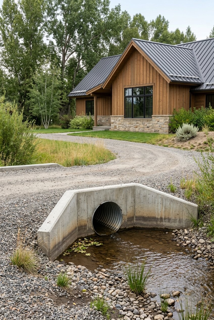
- Identify diversions or ditches: headgates, turnout boxes, or ditches that cross or parallel the property.
- Observe neighboring uses: upstream agriculture or dense subdivisions may influence water quality and privacy.
- Spot flood indicators: debris lines, water stains, raised utilities, or repaired foundations.
Documents to request
- Preliminary title report and all recorded easements, including public access, utilities, and any conservation restrictions.
- Survey with parcel boundaries and, if available, the ordinary high-water mark or mean high-water reference.
- Water right abstracts for any rights included with the property, with file numbers and priority dates.
- FEMA flood maps and any local floodplain permits, variances, or elevation certificates.
- Septic permits and inspection records, plus well logs and water tests for potability and contaminants.
- Permits and reports for any bank stabilization or in-channel work completed on the site.
- Historic photos or aerials to visualize channel migration over time.
Questions to ask
- Does the property include any recorded water rights? What type and priority date? Where is the diversion point?
- Where is the ordinary high-water mark, and has the channel shifted historically on or near the parcel?
- Any flood claims, repeat flooding, or bank repair history?
- Are there conservation easements or stream protection covenants? Any public access agreements?
- Is the septic system compliant, and where could a replacement system go if needed?
- Who maintains private bridges, roads, or riparian improvements serving the property?
Experts to hire
- A real-estate attorney with Montana riparian experience to review title and easements.
- A DNRC water-rights check to verify abstracts and uses.
- A hydrologist or ecologist if banks look unstable or if diversions and permitting are in play.
- A floodplain specialist for map review and an elevation certificate.
- Septic and well inspectors, with lab testing for water quality.
- An appraiser experienced with live-water frontage to value usable bank and entitlements.
Costs and insurance
- Flood insurance may be required if structures sit in a mapped floodplain, and costs vary by elevation and coverage.
- Bank stabilization and riparian maintenance can be significant and ongoing.
- Shared access or bridge agreements may include regular assessments.
How the Gallatin and headwaters shape daily use
Headwater rivers like the Gallatin respond to snowpack and spring runoff. Expect strong spring flows and cooler, lower flows as summer progresses. That seasonality can shape your routines: wading and boating windows, bank access, and where you place outdoor living spaces.
Upstream irrigation diversions may drop late-season flows through your bend. You might also see ditches or headgates on or near the property. If so, confirm who owns and maintains them, along with any easements of record. Bank erosion can also vary year to year. Vegetated buffers and thoughtful access paths help reduce wear and tear.
Channel modifications usually need permits, and some actions are limited to protect stream health and downstream users. If you plan any future improvements, expect to work within local, state, and sometimes federal review. Good planning on the front end saves time and money later.
Valuation nuance: not all frontage is equal
Two riverfront parcels with the same acreage can carry very different values. Buyers and appraisers look closely at:
- Usable frontage length and safe, convenient access.
- Fishery quality and the ability to stage anglers along stable banks.
- Legal entitlements such as water rights, permits, and clean title.
- Hazards like flood exposure and active bank retreat.
- Exclusivity and privacy relative to nearby access points.
Focus less on how many feet of frontage a listing claims and more on how much of it you can actually use without risk or extensive engineering.
Smart offer strategy for live-water
When you find a property you love, craft an offer that gives you the time and information to be confident. Build in due diligence for water rights verification, floodplain review, septic and well inspections, and a title and easement scrub. If timing allows, visit the river at different times of day and, ideally, in different seasons to understand access and flow variability.
If the parcel includes any in-channel or bank structures, request the permits and inspections that document compliant work. If a shared bridge or road is involved, ask for the maintenance agreement and recent assessments. The goal is simple: secure the setting you want, with clear eyes about permissions, costs, and long-term care.
Ready to tour riverfront near Manhattan?
Live-water near Manhattan is special. You get the headwaters setting, trouty water, and room to breathe, along with real considerations around access, rights, and risk. With a local advocate who lives the river lifestyle, you can move faster and protect your interests from day one. If you are exploring riverfront, ranch, or land in the Gallatin Valley, reach out to schedule a conversation with Tyler Garrison. You will get buyer-first guidance, clear due diligence checklists, and local insight on where the best stretches are trading.
FAQs
What does “live-water” mean in Montana real estate?
- It means a perennial, flowing channel like a creek or river that typically supports aquatic life, as opposed to seasonal draws, ponds, or isolated wetlands.
Do I automatically have private fishing rights if I buy riverfront near Manhattan?
- No. In Montana, the public may use the riverbed below the ordinary high-water mark for recreation, while access across private land still requires permission or a legal route.
How do Montana water rights affect a home with river frontage?
- Water rights are separate from land; you need recorded rights to divert or store water, and each right has a type, priority date, and conditions that should be verified.
Will I need flood insurance for a Gallatin River property?
- It depends on FEMA floodplain mapping and structure elevation; many riparian parcels fall in mapped flood zones where lenders may require coverage.
What inspections should I order for a live-water property near Manhattan?
- Prioritize water-rights verification, septic and well inspections, floodplain and elevation review, and a title and easement check, plus a riparian expert if banks look unstable.
How do seasonal flows near the Missouri headwaters affect property use?
- Expect higher spring runoff and lower late-summer flows; this affects wading or boating windows, bank access, and how you plan outdoor spaces and maintenance.